English   Română   Español   Français   Deutsch  

getamap.net

Africa

Oceania

Asia

North America

Europe

South America

Antarctica


Administrative divisions (GPS Maps)

Geography

People and Society

Government

Economy

Communications

Transportation

Military


First settled by the French in the early 17th century, the islands represent the sole remaining vestige of France's once vast North American possessions.


Advertisements:

Advertisements Advertisements


Transportation

Airports World Ranking: 204
2 (2012)

Airports - with paved runways
Total 2
1,524 to 2,437 m 1
914 to 1,523 m 1 (2012)

Roadways World Ranking: 213
Total 117 km
Paved 80 km
Unpaved 37 km (2000)

Ports and terminals
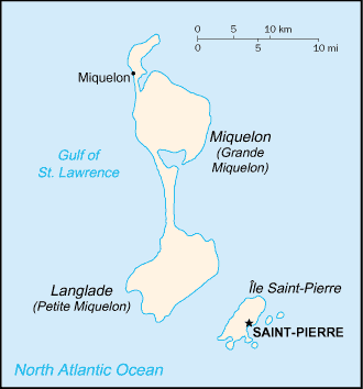
Saint-Pierre


Comments

--- There are no comments yet ---


Add a new comment:


You have to log in to add a comment!


Advertisement


Members area


Register

Forgot password?

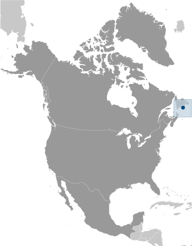
Saint Pierre And Miquelon [ France ] (Overseas Territory):
Country Flag
Country Locator

GPS points from Saint Pierre And Miquelon [ France ] (Overseas Territory)

square Anse Aux Cormorans Saint Pierre And Miquelon (general)

square Brousse A Brehier Saint Pierre And Miquelon (general)

square Cap Coupe Saint Pierre And Miquelon (general)

square La Verrue Saint Pierre And Miquelon (general)

square Cap Corbeau Saint Pierre And Miquelon (general)

square Marais Mouton Saint Pierre And Miquelon (general)

square Butte Au The Saint Pierre And Miquelon (general)

square Le Petit Bec Saint Pierre And Miquelon (general)


viewweather.com sv.ViewWeather.com
fr.ViewWeather.com
da.ViewWeather.com
de.ViewWeather.com
es.ViewWeather.com
www.carpati.org
www.searchromania.net
Deblocari usi
es.getamap.org
fr.getamap.org
de.getamap.org
nl.getamap.org
da.getamap.org
www.getamap.org
Links
Terms of use
Privacy policy

# 0.0205 sec 

contact AT getamap.net

© 2006 - 2024  https://www.getamap.net/